
Page 13

Despairing of any chance of obtaining relief from the Long Island Railroad they determined to build a line of their own. This resulted in the incorporation of the South Side Railroad Company of Long Island in 1860, which was destined to be a serious competitor of the Long Island Railroad. After many plans had been made, the line was finally given out to contract in 1866, and began building east from Jamaica. By September, 1867, it had reached Rockville (now Rockville Centre) and by November it had reached Babylon. The station in Jamaica was just south of the Long Island Railroad Station, being located at Beaver Street. The management of the South Side Railroad wanted the Long Island Railroad to haul its trains from Jamaica to Hunter's Point, but Oliver Charlick was obdurate as usual, and refused to listen to them, even after they had urged every consideration upon him. It is probable that he expected them to meet with financial reverses in the future, at which time he could make better terms with them. This compelled the new road to build its own line to Brooklyn through Bushwick to the Brooklyn waterfront, which it started in 1867. The line ran just south of the Long Island for over a mile west, then crossed and went through Richmond Hill, Glendale and Fresh Pond to Bushwick, being the present Montauk Division trackage to that place.
Stations existed at Ronkonkoma and Holbrook. Holtsville was known as Waverly Station for many years, though changed to the present name after 1890. Medford, another of the first stations, was the stopping place for Patchogue.
Two and a half miles farther east was Bellport Station, named after Bellport on the south shore. This stop was discontinued after the building of the railroad to the south. The next stop was Yaphank, first known as Millville. Then came Manor, now Manorville. The present station at Calverton started as a little siding in the woods for the loading of cordwood, known as "Hulse's Turnout." Later it became a flag station known as Baiting Hollow Station, after a little community to the north, for whose accommodation it was built. After 1890 the present name came into use.
From what has been said, it is evident that the communities on the South Side did not have a very convenient service, their railroad stations being, in most cases, three or more miles north of the town.
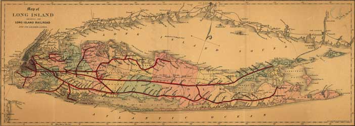
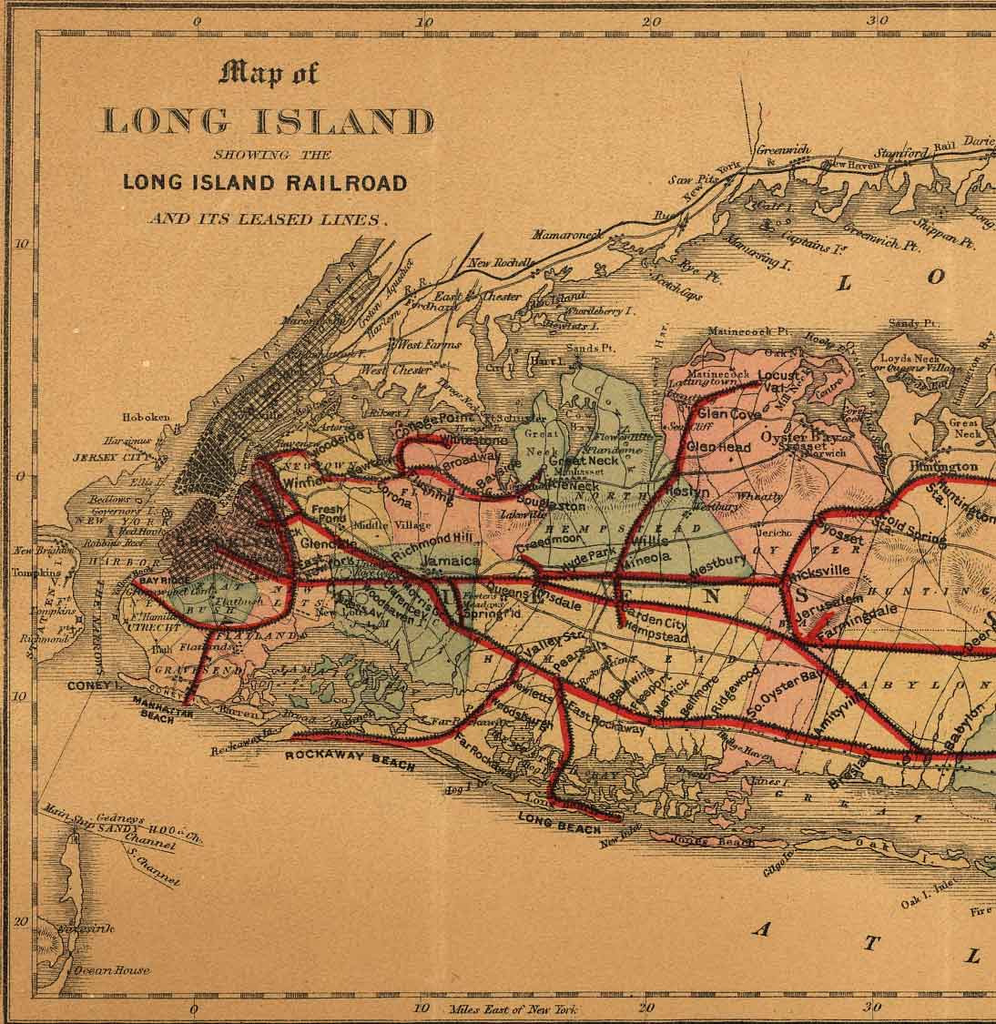
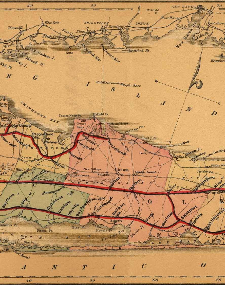
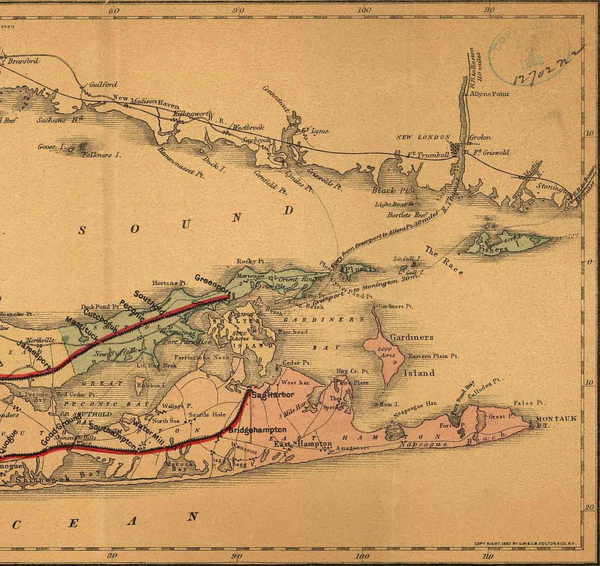
Colton's 1882 Map of the Long Island Railroad and its Leased Lines. Click on the left, middle or right parts of the map for very large images. Brooklyn to Huntington-Babylon (155 KB); Greenlawn-Bay Shore to Riverhead-Westhampton (113 KB); Jamesport-Quogue to East End (130 KB). Also shows the ferries and the "impossible" New Haven Line. Courtesy Library of Congress Geography and Map Division.
Updated
©2001 The Composing Stack Inc. All right reserved